Know the condition of your cycle paths – no survey vehicle required.
Cyface captures the condition of your cycling network using ordinary smartphones: via app, your existing fleet, or a citizen campaign. You receive reliable condition data, clear analyses – and the data belongs to you.
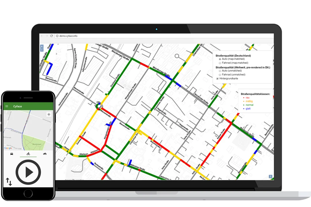
Collection app and interactive condition map – surface quality in four colours
Three ways to your data
You choose how data is collected. We provide the technology, operations and analysis.
Your cycling network is more than segregated cycle paths: it also includes cycle streets, advisory cycle lanes and the quiet side streets where people actually ride. Each part calls for a different collection method – but the result is always the same: a current, objective picture of your entire cycling network.
Everything from a single source – from data collection to AI models
Every project is built from proven building blocks. You only book what you need. Our focus is on cycling infrastructure – on request we also survey footpaths, agricultural and forestry roads and other paths.
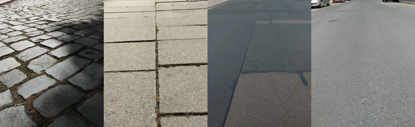
What the four quality classes look like in reality – detected automatically from vibration data.
Typical use case: A municipality wants to know which cycle paths should be repaired first. Cyface surveys the network, classifies every segment by surface quality and delivers a prioritised map – as a basis for construction programmes and funding applications.
How it works
From first idea to finished condition map
1
Consultation & project scoping
Together we clarify your objectives, the survey area and the most suitable collection method – fleet-based survey, citizen campaign or SDK integration.
2
Data collection
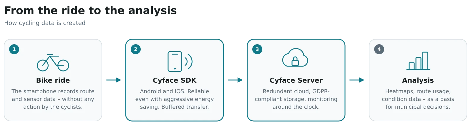
Smartphones record acceleration, rotation and position data while riding or driving – mounted in vehicles that are already on the road every day, or in your citizens’ own phones. For campaigns, we work with experienced partners such as DigiPL GmbH and Klima-Bündnis Services GmbH.
3
Analysis
Our data collection service receives the data; we compute surface quality and further metrics and prepare everything clearly – as a map, a report and a data export.
4
Your data, your decision
You receive all raw and result data in open formats. Whether for maintenance planning, research or your own AI model – you continue working with it however you like.
Why Cyface
No lock-in. No data hoarding. No black box.
Open Source
Software that can’t run away from you
The core of our software is openly available on GitHub. That means full transparency – and security: the solution can in principle keep running even after our contract ends. No vendor lock-in.
Full access to the source code
Dual licensing on request: we hold all copyrights and can provide any component under a commercial licence as well
Data sovereignty
Your data stays your data
Many providers ultimately sell you only an analysis – and keep the raw data for themselves. We do it differently: we merely manage your data. You control it, can export it at any time and publish it as open data.
Raw and result data in open formats
Hosting in Germany or in your own infrastructure
GDPR-compliant processing
Field-proven
Used by millions
In the STADTRADELN app, our technology has captured the trips of over 1 million users a year for more than 8 years (as of 2025). We trialled fleet-based surveys at city scale in Saarlouis and Leipzig, among others.
Scalable
Technology that grows with you
Our data collection service is based on Vert.x and scales horizontally in the cloud – from a pilot project with a handful of vehicles to a nationwide campaign.
Packages & pricing
Clear packages instead of surprises
Every project is different – but you should know from the start what to expect. That is why we work with three packages and transparent add-on modules.
For municipalities & engineering firms
Fleet-based Survey
Your existing vehicles collect the data along the way – you receive the finished condition map.
from €3,500
Project fee €3,000 + €7–12/km of network (tiered by network size)
Installation of the smartphones in your vehicles
Monitoring of the ongoing collection
Surface analysis in four quality classes
Interactive map & results report
Complete data export in open formats
Project duration approx. 6–12 weeks depending on network size
Portal access & hosting 6 months included – extension €90/month or €900/year
For municipalities with citizen engagement
Citizen Campaign
Your citizens collect data via app – we take care of everything else.
from €5,000
Base price per campaign, tiered by municipality size
Collection app in your corporate design
Hosting & operation during the campaign
Campaign support with experienced partners
Analysis: surface quality & usage heatmap
Final report & complete data export
Campaign runtime approx. 3 months
Portal access & hosting 6 months included – extension €90/month or €900/year
For institutions with their own app
Platform & SDK
You integrate our SDK – we provide infrastructure and support.
from €390/ month
plus one-off integration support billed on time spent · API free tier included
Open-source SDK for Android & iOS
Data collection service incl. operation & updates
API access to raw and result data
Technical support with guaranteed response times
Optional: self-hosting in your infrastructure
Add-on modules – available with every package
Optional – you can also decide on the add-on modules later in our conversation.
All prices exclude VAT. For universities and research institutions we offer special rates and support with third-party funding applications. Get in touch.
Projects & partners
Proven in the field
From a nationwide cycling campaign to municipal fleet-based surveys – from research into practice for over a decade.
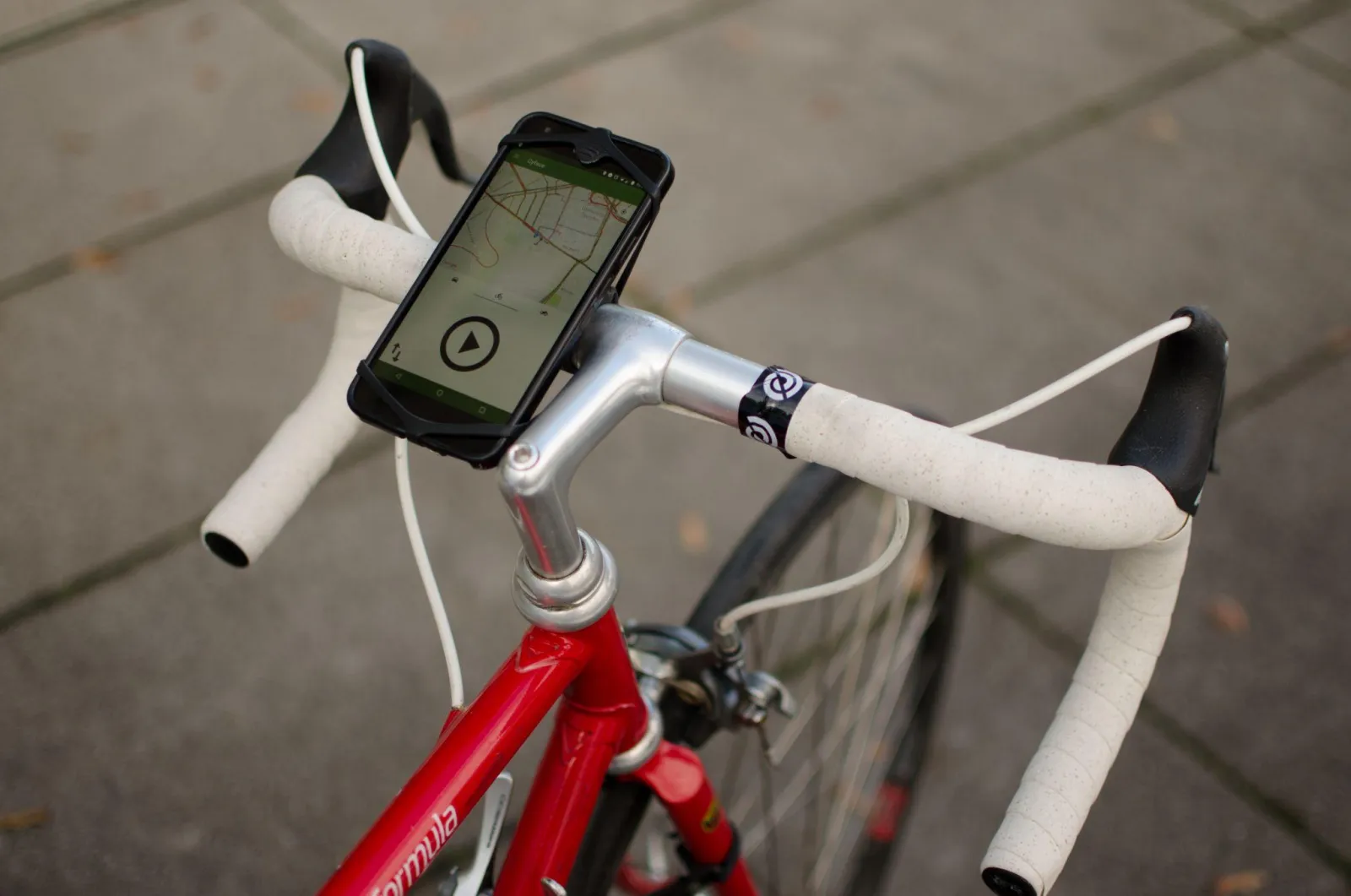
The Cyface app in action – capturing data during everyday rides, straight from the bike.
Since 2018, Cyface technology has captured the trips of the STADTRADELN campaign. How we handle the load of more than 3,000 municipalities – and what municipalities gain from the data.
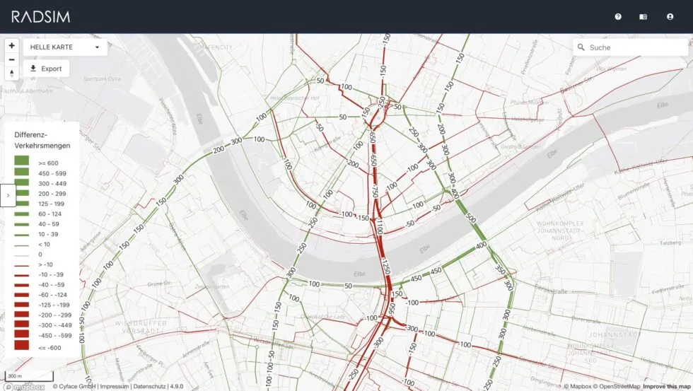
Whether traffic-calmed zones, new cycle highways or roadworks: with the new RadSim platform, cycling flows can now be simulated precisely and on a data-driven basis – available nationwide from now on.
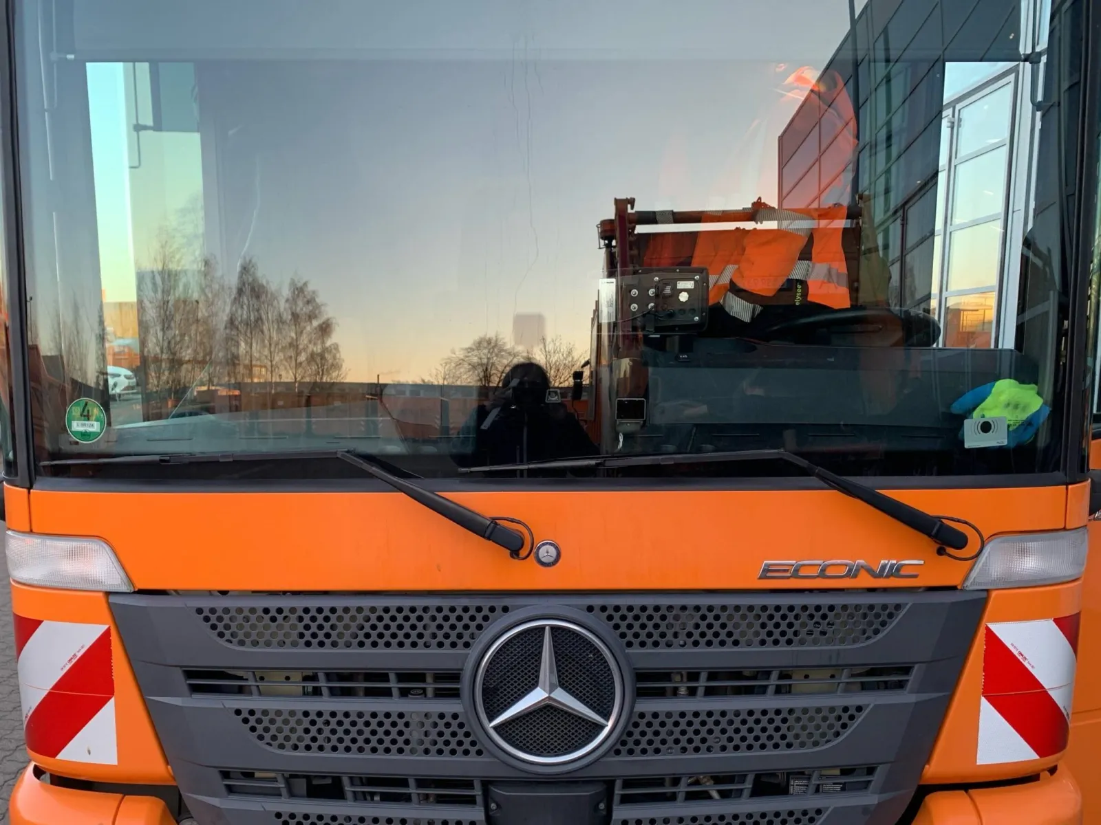
Three and a half years of mFund research in Leipzig: waste collection vehicles as mobile sensors – and an AI model for the automated detection of road damage.
Cyface grew out of fundamental research at TU Dresden – founded and run by two engineers who keep research and product in one pair of hands.
Co-founder · Research & system architecture
Dr. Klemens Muthmann
Machine-learning expert. Leads Cyface’s research work and system architecture.
Co-founder · Software & hardware
Armin Schnabel
Passionate developer. Responsible for software and hardware development – from the SDK to the data collection service.
Let’s talk about your cycling network.
Whether you have a concrete tender or just a first idea – we will advise you, without obligation, on which collection method fits your project and budget.